Geolocate

Lecina topographic map

Click on the map to display elevation.

About this map

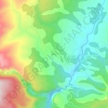
Name: Lecina topographic map, elevation, terrain.

Location: Lecina, Bárcabo, Sobrarbe, Huesca, Aragon, 22148, Spain (42.20979 0.01500 42.24979 0.05500)

Average elevation: 805 m

Minimum elevation: 632 m

Maximum elevation: 1,120 m

Gear up for your next adventure:

🦟Insect Repellent - Keep mosquitoes and black flies away in wooded areas
🧥Insulated Jacket - Keep warm in cold outdoor conditions
🔭Compact Monocular - One-handed bird watching and trail spotting
🥾Approach Shoes - Shoes designed for climbing approaches and rugged trails
👖Convertible Hiking Pants - Zip-off legs to adapt to changing weather conditions

As an Amazon Associate, this site earns from qualifying purchases at no extra cost to you.