Geolocate

Koteshwar topographic map

Click on the map to display elevation.

About this map

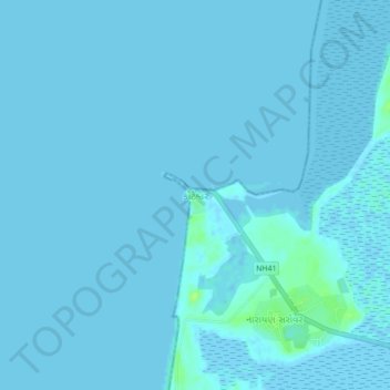
Name: Koteshwar topographic map, elevation, terrain.

Location: Koteshwar, Lakhpat Taluka, Kachchh, Gujarat, 370601, India (23.66764 68.50827 23.70764 68.54827)

Average elevation: 1 m

Minimum elevation: -1 m

Maximum elevation: 11 m

Other topographic maps

Click on a map to view its topography, its elevation and its terrain.

Gear up for your next adventure:

🧴Bear Spray Holster - Quick-access carry for essential Canadian wilderness safety
🧰Survival Kit - Essential gear for emergencies in the wilderness
🧳Compression Sacks - Maximize space in your backpack by shrinking gear
🧣Evaporative Cooling Towel - Beat the heat during intense summer climbs
🏃Hydration Running Vest - Carry water and maps close to your body for speed

As an Amazon Associate, this site earns from qualifying purchases at no extra cost to you.