Geolocate

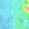
Vacaville topographic map

Click on the map to display elevation.

About this map

Name: Vacaville topographic map, elevation, terrain.

Location: Vacaville, Solano County, California, United States (38.30831 -122.03245 38.41829 -121.89491)

Average elevation: 90 m

Minimum elevation: 20 m

Maximum elevation: 496 m

Other topographic maps

Click on a map to view its topography, its elevation and its terrain.
Mare Island

United States > California > Solano County > Vallejo

Average elevation: 107 m

Molena

United States > California > Solano County

Average elevation: 22 m

Vallejo

United States > California > Solano County > Vallejo

Average elevation: 47 m

Clima

United States > California > Solano County

Average elevation: 13 m

Creed

United States > California > Solano County

Average elevation: 12 m

Bunker

United States > California > Solano County

Average elevation: 5 m

Gear up for your next adventure:

☕Camping Coffee Maker - Brew fresh coffee anywhere on the topographic map
🧣Evaporative Cooling Towel - Beat the heat during intense summer climbs
⛺Lightweight Camping Tent - Portable shelter optimized for Canadian backcountry camping
🦶Hiking Shoe Insoles - Added support for high arches and long days on feet
🥾Light Trekking Boots - Supportive boots for multi-day treks

As an Amazon Associate, this site earns from qualifying purchases at no extra cost to you.