Geolocate

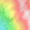
La Buffaz topographic map

Click on the map to display elevation.

About this map

Name: La Buffaz topographic map, elevation, terrain.

Location: La Buffaz, Saint-Michel-de-Maurienne, Saint-Jean-de-Maurienne, Savoie, Auvergne-Rhône-Alpes, France métropolitaine, 73140, France (45.19655 6.47017 45.23655 6.51017)

Average elevation: 1,203 m

Minimum elevation: 701 m

Maximum elevation: 2,316 m

Other topographic maps

Click on a map to view its topography, its elevation and its terrain.
Gear up for your next adventure:

❄️Traction Ice Cleats - Slip-on spikes for icy trails and winter hiking
💡Portable Camping Lamp - Rechargeable lamp for campsite lighting
🧴First Aid Kit - Essential first aid supplies for outdoor emergencies
🧥Ultralight Puffy Jacket - Maximum warmth that packs down to the size of an orange
🧥Waterproof Hiking Jacket - Protect yourself from rain and wind while hiking

As an Amazon Associate, this site earns from qualifying purchases at no extra cost to you.