Geolocate

Kasarani topographic map

Click on the map to display elevation.

About this map

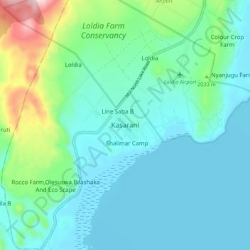
Name: Kasarani topographic map, elevation, terrain.

Location: Kasarani, Malewa West ward, Gilgil, Nakuru, Kenya (-0.75403 36.25775 -0.67403 36.33775)

Average elevation: 1,969 m

Minimum elevation: 1,880 m

Maximum elevation: 2,347 m

Gear up for your next adventure:

🥾Trail Hiking Shoes - Durable shoes designed for rugged trails
🧢Outdoor Visor - Breathable visor for sunny hikes
🥾Trail Hiking Socks - Comfortable socks to prevent blisters and fatigue
🧤Insulated Winter Gloves - Heavy-duty protection for sub-zero Canadian adventures
Camping Coffee Maker - Brew fresh coffee anywhere on the topographic map

As an Amazon Associate, this site earns from qualifying purchases at no extra cost to you.