
Make a donation
Gear up for your next adventure:
As an Amazon Associate, this site earns from qualifying purchases at no extra cost to you.
Ettersburg topographic map
Click on the map to display elevation.
Make a donation
Gear up for your next adventure:
As an Amazon Associate, this site earns from qualifying purchases at no extra cost to you.
About this map
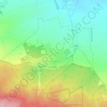
Name: Ettersburg topographic map, elevation, terrain.
Average elevation: 316 m
Minimum elevation: 244 m
Maximum elevation: 437 m
Make a donation
Gear up for your next adventure:
As an Amazon Associate, this site earns from qualifying purchases at no extra cost to you.
Other topographic maps
Click on a map to view its topography, its elevation and its terrain.
Herressen-Sulzbach
Deutschland > Thüringen > Landkreis Weimarer Land > Apolda
Average elevation: 227 m
Keßlar
Deutschland > Thüringen > Landkreis Weimarer Land > Blankenhain > Keßlar
Average elevation: 413 m
Make a donation
Gear up for your next adventure:
As an Amazon Associate, this site earns from qualifying purchases at no extra cost to you.
Make a donation
Gear up for your next adventure:
As an Amazon Associate, this site earns from qualifying purchases at no extra cost to you.
Lohteich
Deutschland > Thüringen > Landkreis Weimarer Land > Apolda > Herressen
Average elevation: 198 m
Make a donation
Gear up for your next adventure:
As an Amazon Associate, this site earns from qualifying purchases at no extra cost to you.
Daasdorf
Deutschland > Thüringen > Landkreis Weimarer Land
Daasdorf liegt etwa zehn Kilometer nördlich von Weimar im Südosten des Thüringer Beckens auf einer Höhe von etwa 200 Metern. Etwa sieben Kilometer südwestlich erhebt sich der 478 Meter hohe Ettersberg. Am Westrand des Ortes fließt der Bach Rassel, der über Scherkonde und Lossa mit der Unstrut verbunden ist.
Average elevation: 226 m
Make a donation
Gear up for your next adventure:
As an Amazon Associate, this site earns from qualifying purchases at no extra cost to you.
Oberroßla
Deutschland > Thüringen > Landkreis Weimarer Land > Apolda > Oberroßla
Average elevation: 208 m
Obergrunstedt
Deutschland > Thüringen > Landkreis Weimarer Land
Obergrunstedt liegt in einer flachen Mulde am Südostrand des Thüringer Beckens auf einer Höhe von etwa 350 m ü. NHN. Der Ortsteil liegt nördlich der Bundesautobahn 4 zwischen Weimar und Erfurt. Über Ortsverbindungsstraßen und die Weimar-Berka-Blankenhainer Eisenbahn ist das Dorf erreichbar.
Average elevation: 336 m
Make a donation
Gear up for your next adventure:
As an Amazon Associate, this site earns from qualifying purchases at no extra cost to you.
Neckeroda
Deutschland > Thüringen > Landkreis Weimarer Land > Blankenhain
Das Bauerndorf liegt 5,5 km südlich von Blankenhain auf einer mittleren Höhe von 465 m NN auf einer kupierten Hochebene. Die höchste Erhebung ist 477,7 m NN. Die Bundesstraße 85 führt im östlichen Dorfrand vorbei. In östlicher Richtung gen Wittersroda befindet sich ein unwegsames Waldgelände. In…
Average elevation: 447 m