Geolocate

Gabawan topographic map

Click on the map to display elevation.

About this map

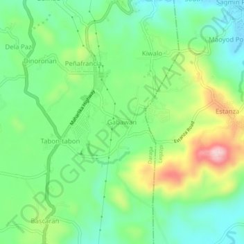
Name: Gabawan topographic map, elevation, terrain.

Location: Gabawan, Daraga, Albay, Bicol Region, 4501, Philippines (13.10107 123.69106 13.14107 123.73106)

Average elevation: 98 m

Minimum elevation: 11 m

Maximum elevation: 266 m

Gear up for your next adventure:

🚲Heavy Duty Bike Lock - Secure your bike at the trailhead or during stops
🧴Insect Repellent - Protect yourself from bugs during outdoor adventures
🧊Insulated Water Bottle - Keeps drinks cold in summer and prevents freezing in winter
🥾Mountain Hiking Boots - High-traction boots for rocky terrain
🩹Compact First Aid Kit - Pre-packed essentials for common trail injuries

As an Amazon Associate, this site earns from qualifying purchases at no extra cost to you.