Geolocate

Roquetes topographic map

Click on the map to display elevation.

About this map

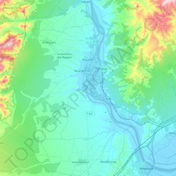
Name: Roquetes topographic map, elevation, terrain.

Location: Roquetes, Baix Ebre, Tarragona, Catalonia, 43520, Spain (40.73635 0.27073 40.84562 0.51044)

Average elevation: 142 m

Minimum elevation: -2 m

Maximum elevation: 772 m

Gear up for your next adventure:

Backpacking Tent - Lightweight tent for long-distance hiking trips
🔨Vehicle Emergency Tool - Safety tool for remote road trips to trailheads
👟Leg Gaiters - Keep debris, mud, and snow out of your boots
🥾Hiking Gaiters - Protect legs and shoes from mud, snow, and debris
🥾Mountain Hiking Shoes - Shoes with superior grip for mountainous terrain

As an Amazon Associate, this site earns from qualifying purchases at no extra cost to you.