Geolocate

Tenerife topographic map

Click on the map to display elevation.

About this map

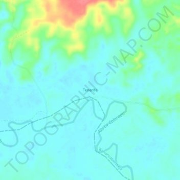
Name: Tenerife topographic map, elevation, terrain.

Location: Tenerife, Barrancabermeja, Yariguíes, Santander, RAP Gran Santander, Colombia (6.87635 -73.82723 6.91635 -73.78723)

Average elevation: 91 m

Minimum elevation: 77 m

Maximum elevation: 142 m

Other topographic maps

Click on a map to view its topography, its elevation and its terrain.

Río Opón

Colombia > Santander > Barrancabermeja

Average elevation: 78 m

Gear up for your next adventure:

🎒Hiking Backpack - Lightweight and ergonomic backpacks for day hikes or multi-day treks
🔭Compact Monocular - One-handed bird watching and trail spotting
🛶Waterproof Dry Bags - Keep electronics and clothes dry during river crossings
🥾Mountain Hiking Shoes - Shoes with superior grip for mountainous terrain
🧰Multitool Knife - Compact and versatile tool for outdoor use

As an Amazon Associate, this site earns from qualifying purchases at no extra cost to you.