
Floresta topographic map
Interactive map
Click on the map to display elevation.
About this map
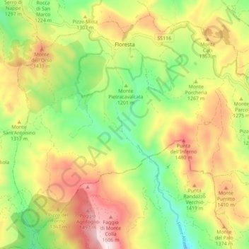
Name: Floresta topographic map, elevation, terrain.
Location: Floresta, Mesina, Sicilia, 98030, Italia (37.93523 14.87062 37.99542 14.95734)
Average elevation: 1,255 m
Minimum elevation: 966 m
Maximum elevation: 1,604 m