
Make a donation
Gear up for your next adventure:
As an Amazon Associate, this site earns from qualifying purchases at no extra cost to you.
Vergötschen topographic map
Click on the map to display elevation.
Make a donation
Gear up for your next adventure:
As an Amazon Associate, this site earns from qualifying purchases at no extra cost to you.
About this map
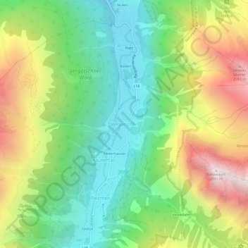
Name: Vergötschen topographic map, elevation, terrain.
Average elevation: 1,843 m
Minimum elevation: 1,206 m
Maximum elevation: 2,866 m
Make a donation
Gear up for your next adventure:
As an Amazon Associate, this site earns from qualifying purchases at no extra cost to you.
Other topographic maps
Click on a map to view its topography, its elevation and its terrain.
St. Christina
Österreich > Tirol > Bezirk Landeck > Gemeinde Ried im Oberinntal
Average elevation: 1,155 m
Kartellsee
Österreich > Tirol > Bezirk Landeck > Gemeinde Sankt Anton am Arlberg
Average elevation: 2,511 m
Make a donation
Gear up for your next adventure:
As an Amazon Associate, this site earns from qualifying purchases at no extra cost to you.
Kaunertaler Gletscherstraße
Österreich > Tirol > Bezirk Landeck > Gemeinde Kaunertal
Average elevation: 2,055 m
Kaunerberg
Österreich > Tirol > Bezirk Landeck
Der Ort Kaunerberg liegt über dem Eingang zum Kaunertal auf zahlreichen verstreuten Weilern und Höfen zwischen 1300 m und 1600 m Höhe. Von hier führt eine Straße über die Pillerhöhe weiter in das Pitztal. Das Gemeindegebiet steigt auf der Sonnseite des Tales zuerst bewaldet, dann über Almen und…
Average elevation: 1,801 m