
George Town topographic map
Click on the map to display elevation.
George Town
The jurisdiction of George Town covers an area of approximately 306 km2 (118 sq mi), encompassing the entirety of Penang Island and nine surrounding islets. George Town is slightly more than two-fifths the size of Singapore. The 295 km2 (114 sq mi) Penang Island has an uneven terrain with a mountainous topography down the middle. The island's coastal plains are narrow, with the most extensive plain located at the northeastern cape, where the 25.5 km2 (9.8 sq mi) city centre is situated. Over the centuries, the built-up area of George Town has expanded in three directions – along the island's northern coast, south down the eastern shoreline and towards Penang Hill to the west.
About this map
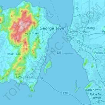
Name: George Town topographic map, elevation, terrain.
Location: George Town, Penang, Malaysia (5.22500 100.17498 5.48291 100.34663)
Average elevation: 55 m
Minimum elevation: -5 m
Maximum elevation: 802 m
Other topographic maps
Click on a map to view its topography, its elevation and its terrain.
Kampung Tersusun Pongsu Seribu
Malaysia > Penang > Kepala Batas > Kampung Tersusun Pongsu Seribu
Average elevation: 6 m