Geolocate

Uchuy topographic map

Click on the map to display elevation.

About this map

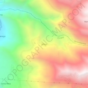
Name: Uchuy topographic map, elevation, terrain.

Location: Uchuy, Chugay, Sánchez Carrión, La Libertad, Perú (-7.67441 -77.83902 -7.63441 -77.79902)

Average elevation: 2,676 m

Minimum elevation: 1,799 m

Maximum elevation: 3,512 m

Gear up for your next adventure:

🌬️Windproof Camp Stove - Efficient cooking even on exposed mountain peaks
🧥Thermal Fleece Jacket - Versatile insulation for changing mountain temperatures
🪑Ultralight Camping Stool - Compact seating for rest stops during long hikes
🥾Trekking Boots - Durable boots for long-distance trekking
🥾Trail Hiking Socks - Comfortable socks to prevent blisters and fatigue

As an Amazon Associate, this site earns from qualifying purchases at no extra cost to you.