
Üllő topographic map
Interactive map
Click on the map to display elevation.
About this map
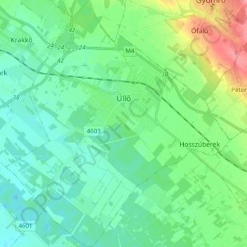
Name: Üllő topographic map, elevation, terrain.
Average elevation: 128 m
Minimum elevation: 109 m
Maximum elevation: 182 m
Other topographic maps
Click on a map to view its topography, its elevation and its terrain.
Budaörsi kopárok TT
Hongrie > Pest vármegye > Budaörs
Budaörsi kopárok TT, Hegyalja köz, Odvashegy, Hegyvidékek, Budaörs, Budakeszi járás, Pest vármegye, Hongrie centrale, 2040, Hongrie
Average elevation: 260 m