
Iñuma topographic map
Interactive map
Click on the map to display elevation.
About this map
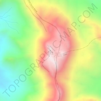
Name: Iñuma topographic map, elevation, terrain.
Location: Iñuma, Tarata, Tacna, Peru (-17.45858 -69.83931 -17.45848 -69.83921)
Average elevation: 5,300 m
Minimum elevation: 4,961 m
Maximum elevation: 5,629 m