Lake Fields topographic map
Interactive map
Click on the map to display elevation.
About this map
![Lake Fields topographic map, elevation, terrain](/pub/maps/way/sr9m/46hfjnh/thumbnail.jpg)
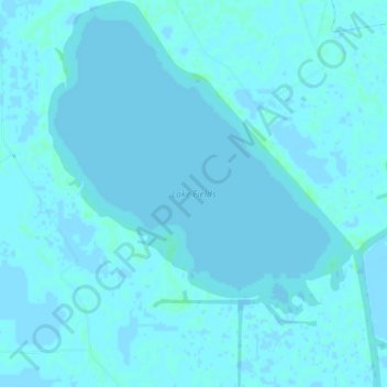
Name: Lake Fields topographic map, elevation, terrain.
Location: Lake Fields, Lafourche Parish, Louisiana, United States (29.62049 -90.60198 29.66689 -90.55964)
Average elevation: 1 m
Minimum elevation: -3 m
Maximum elevation: 5 m
Other topographic maps
Click on a map to view its topography, its elevation and its terrain.
![Mathews topographic map, elevation, terrain](/pub/maps/relation/8414/37bgp/icon.jpg)
Mathews
United States > Louisiana > Lafourche Parish
Mathews, Lafourche Parish, Louisiana, United States
Average elevation: 3 m