Geolocate

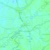
Dulong Ilog topographic map

Click on the map to display elevation.

About this map

Name: Dulong Ilog topographic map, elevation, terrain.

Location: Dulong Ilog, Candaba, Pampanga, Central Luzon, Philippines (15.03278 120.84421 15.05922 120.87222)

Average elevation: 8 m

Minimum elevation: 5 m

Maximum elevation: 12 m

Other topographic maps

Click on a map to view its topography, its elevation and its terrain.

Paligui

Philippines > Pampanga > Candaba

Average elevation: 9 m

Pulong Palazan

Philippines > Pampanga > Candaba

Average elevation: 11 m

Vizal San Pablo

Philippines > Pampanga > Candaba

Average elevation: 11 m

Mangga

Philippines > Pampanga > Candaba

Average elevation: 10 m

Paligui

Philippines > Pampanga > Candaba

Average elevation: 9 m

Vizal San Pablo

Philippines > Pampanga > Candaba

Average elevation: 11 m

Cuayang Bugtong

Philippines > Pampanga > Candaba

Average elevation: 11 m

Pangclara

Philippines > Pampanga > Candaba

Average elevation: 10 m

Gear up for your next adventure:

❄️Traction Ice Cleats - Slip-on spikes for icy trails and winter hiking
🥾Approach Shoes - Shoes designed for climbing approaches and rugged trails
🚲Heavy Duty Bike Lock - Secure your bike at the trailhead or during stops
🧢Hiking Hat - Sun-protective and breathable hats for long treks
🥾Mountain Hiking Shoes - Shoes with superior grip for mountainous terrain

As an Amazon Associate, this site earns from qualifying purchases at no extra cost to you.