Geolocate

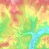
Salvezou topographic map

Click on the map to display elevation.

About this map

Name: Salvezou topographic map, elevation, terrain.

Location: Salvezou, Catus, Cahors, Lot, Occitanie, France métropolitaine, 46150, France (44.55948 1.32949 44.59948 1.36949)

Average elevation: 273 m

Minimum elevation: 174 m

Maximum elevation: 345 m

Other topographic maps

Click on a map to view its topography, its elevation and its terrain.
46150

France > Occitanie > Lot > Catus

Average elevation: 231 m

46150

France > Occitanie > Lot > Catus

Average elevation: 232 m

Gear up for your next adventure:

🌡️Emergency Mylar Blankets - Compact thermal protection for unexpected nights outdoors
🕶️Polarized Sunglasses - Protect your eyes with durable polarized lenses
🛶Canoe Life Vest - Safety vest for water sports
🛶Kayak Dry Bag - Waterproof storage for kayaking adventures
🧭GPS Tracker - Track your location in remote areas safely

As an Amazon Associate, this site earns from qualifying purchases at no extra cost to you.