Geolocate

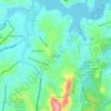
São Gabriel topographic map

Click on the map to display elevation.

About this map

Name: São Gabriel topographic map, elevation, terrain.

Location: São Gabriel, Regional Nordeste, Belo Horizonte, Minas Gerais, Região Sudeste, 31980-580, Brasil (-19.86489 -43.92769 -19.84627 -43.90569)

Average elevation: 784 m

Minimum elevation: 720 m

Maximum elevation: 852 m

Other topographic maps

Click on a map to view its topography, its elevation and its terrain.
Praça do Sol

Brasil > Minas Gerais > Belo Horizonte

Average elevation: 1,060 m

Itamarati

Brasil > Minas Gerais > Belo Horizonte > Pampulha

Average elevation: 831 m

Serra do Curral

Brasil > Minas Gerais > Belo Horizonte

Average elevation: 1,115 m

Gear up for your next adventure:

💡Compact LED Flashlight - Powerful and portable flashlight for outdoor use
🧣Merino Neck Gaiter - Protects against wind, sun, and cold at high altitudes
💧Reusable Water Bottle - Durable water bottles for hydration on trails
💧Hydration Bladder - Hands-free hydration solution for long treks
🧳Compression Sacks - Maximize space in your backpack by shrinking gear

As an Amazon Associate, this site earns from qualifying purchases at no extra cost to you.