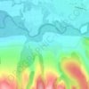
Borlova topographic map
Click on the map to display elevation.
About this map

Name: Borlova topographic map, elevation, terrain.
Location: Borlova, Turnu Ruieni, Caraș-Severin, 327406, Romania (45.34738 22.33200 45.38738 22.37200)
Average elevation: 413 m
Minimum elevation: 305 m
Maximum elevation: 712 m
Other topographic maps
Click on a map to view its topography, its elevation and its terrain.

Băile Herculane
Băile Herculane (Latin: Aqua Herculis; German: Herkulesbad; Hungarian: Herkulesfürdő; Czech: Herkulovy Lázně, Turkish: Lazarethane, English: Herculean Baths) is a spa town in Romanian Banat, in Caraș-Severin County, situated in the valley of the Cerna River, between the Mehedinți Mountains to the east…
Average elevation: 571 m



Mehadia
Mehadia is located in southwestern Romania in the Cerna valley at an elevation of 287 m (942 ft). It is located along European route E70, south of the village of Plugova and north of Topleț. Beyond Topleț to the south is Orșova, which was for many years the residence of a Pasha and contained a prominent…
Average elevation: 613 m


Băile Herculane
Băile Herculane (Latin: Aqua Herculis; German: Herkulesbad; Hungarian: Herkulesfürdő; Czech: Herkulovy Lázně, Turkish: Lazarethane) is a spa town in Romanian Banat, in Caraș-Severin County, situated in the valley of the Cerna River, between the Mehedinți Mountains to the east and the Cerna Mountains to…
Average elevation: 571 m


Teregova
The commune is located in the east-central part of county, stretching eastwards to the border with Hunedoara County. It is situated at an altitude of 424 m (1,391 ft), at the foot of the Țarcu Mountains. The river Timiș flows through Rusca village; its right tributary, the river Teregova, joins the Timiș in…
Average elevation: 803 m