Geolocate

Sudapin topographic map

Click on the map to display elevation.

About this map
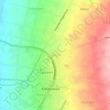
Name: Sudapin topographic map, elevation, terrain.

Location: Sudapin, Kidapawan, Cotabato, Soccsksargen, 9400, Philippines (7.00180 125.07209 7.04180 125.11209)

Average elevation: 285 m

Minimum elevation: 206 m

Maximum elevation: 374 m

Other topographic maps

Click on a map to view its topography, its elevation and its terrain.

Pulangi River

Philippines > Cotabato > Kidapawan

Average elevation: 440 m

Matingao River

Philippines > Cotabato > Kidapawan > Balabag

Average elevation: 605 m

Gear up for your next adventure:

🥤Collapsible Travel Cup - Saves space and weight in your mess kit
🧥Ultralight Puffy Jacket - Maximum warmth that packs down to the size of an orange
🧥Softshell Hiking Jacket - The perfect balance of wind protection and breathability
🧥Waterproof Pants - Keep dry during rainy hiking conditions
🥽Outdoor Goggles - Protective eyewear for outdoor activities

As an Amazon Associate, this site earns from qualifying purchases at no extra cost to you.