
Hohenstein topographic map
Interactive map
Click on the map to display elevation.
About this map
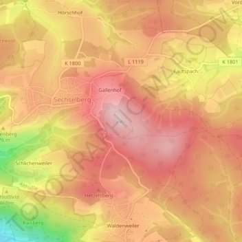
Name: Hohenstein topographic map, elevation, terrain.
Average elevation: 489 m
Minimum elevation: 317 m
Maximum elevation: 571 m
Other topographic maps
Click on a map to view its topography, its elevation and its terrain.
Strümpfelbach
Deutschland > Baden-Württemberg > Althütte
Strümpfelbach, Althütte, Vereinbarte Verwaltungsgemeinschaft der Stadt Backnang, Rems-Murr-Kreis, Regierungsbezirk Stuttgart, Baden-Württemberg, 71566, Deutschland
Average elevation: 496 m