
Seeboden topographic map
Interactive map
Click on the map to display elevation.
About this map
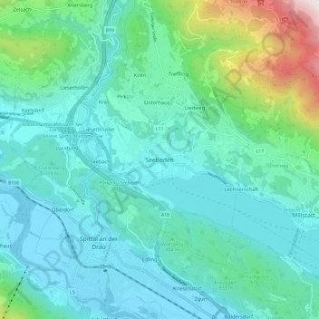
Name: Seeboden topographic map, elevation, terrain.
Location: Seeboden, Spittal an der Drau, Carinthia, 9871, Austria (46.77907 13.47865 46.85907 13.55865)
Average elevation: 808 m
Minimum elevation: 528 m
Maximum elevation: 2,090 m