Geolocate

Métaneige topographic map

Click on the map to display elevation.

About this map
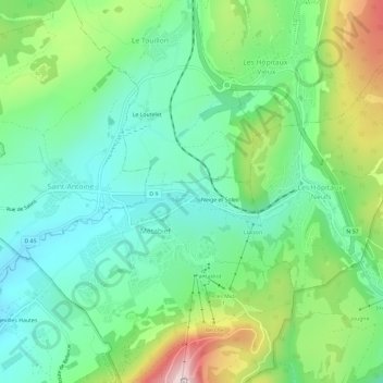
Name: Métaneige topographic map, elevation, terrain.

Location: Métaneige, Métabief, Pontarlier, Doubs, Bourgogne-Franche-Comté, France métropolitaine, 25370, France (46.75630 6.33605 46.79630 6.37605)

Average elevation: 1,041 m

Minimum elevation: 917 m

Maximum elevation: 1,317 m

Other topographic maps

Click on a map to view its topography, its elevation and its terrain.
Lac du Morond

France > Bourgogne-Franche-Comté > Doubs > Métabief

Average elevation: 1,178 m

Gear up for your next adventure:

🧥Packable Rain Jacket - Breathable waterproof layer for unpredictable weather
🛰️Satellite Messenger - Emergency communication for areas with no cell service
🛶Waterproof Dry Bags - Keep electronics and clothes dry during river crossings
🦶Anti-Blister Balm - Prevents friction and hotspots during long ascents
🧥Waterproof Pants - Keep dry during rainy hiking conditions

As an Amazon Associate, this site earns from qualifying purchases at no extra cost to you.