Geolocate

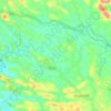
Vilappil topographic map

Click on the map to display elevation.

About this map

Name: Vilappil topographic map, elevation, terrain.

Location: Vilappil, Kattakkada, Thiruvananthapuram, Kerala, 695573, India (8.50568 77.01168 8.54568 77.05168)

Average elevation: 57 m

Minimum elevation: 11 m

Maximum elevation: 151 m

Other topographic maps

Click on a map to view its topography, its elevation and its terrain.

Neyyar Dam

India > Kerala > Kattakkada

Average elevation: 91 m

Amboori

India > Kerala > Kattakkada

Average elevation: 173 m

Poovachal

India > Kerala > Kattakkada > Uriyacode

Average elevation: 84 m

Vellanad

India > Kerala > Kattakkada > Uriyacode

Average elevation: 77 m

Neyyar

India > Kerala > Kattakkada > Keezharoor

Average elevation: 57 m

Sasthampara

India > Kerala > Kattakkada > Vilappilsala

Average elevation: 69 m

Kattachal chira

India > Kerala > Kattakkada > Kattakada

Average elevation: 75 m

Vellanad

India > Kerala > Kattakkada > Uriyacode

Average elevation: 77 m

Gear up for your next adventure:

💧Collapsible Water Bottle - Space-saving water bottle for outdoor activities
🔭Outdoor Binoculars - Lightweight binoculars for birdwatching and hiking
🧴Outdoor Sunscreen - High SPF protection for high-altitude UV exposure
💧Filtered Water Bottle - Safe drinking water on the go
🐕Hiking Dog Pack - Let your canine companion carry their own water and food

As an Amazon Associate, this site earns from qualifying purchases at no extra cost to you.