Geolocate

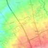
Bagong Pook topographic map

Click on the map to display elevation.

About this map

Name: Bagong Pook topographic map, elevation, terrain.

Location: Bagong Pook, Malvar, Batangas, Calabarzon, 4233, Philippines (14.02619 121.16476 14.05159 121.18413)

Average elevation: 231 m

Minimum elevation: 194 m

Maximum elevation: 272 m

Other topographic maps

Click on a map to view its topography, its elevation and its terrain.

Bulihan

Philippines > Batangas > Malvar

Average elevation: 186 m

San Pedro II

Philippines > Batangas > Malvar

Average elevation: 174 m

San Pedro I

Philippines > Batangas > Malvar

Average elevation: 186 m

Luta Del Sur

Philippines > Batangas > Malvar

Average elevation: 227 m

Bagong Pook

Philippines > Batangas > Malvar

Average elevation: 234 m

Luta Del Norte

Philippines > Batangas > Malvar

Average elevation: 218 m

Bilucao

Philippines > Batangas > Malvar

Average elevation: 94 m

San Isidro East

Philippines > Batangas > Malvar

Average elevation: 147 m

Luta Del Sur

Philippines > Batangas > Malvar

Average elevation: 227 m

Gear up for your next adventure:

🧰Multitool Knife - Compact and versatile tool for outdoor use
🔦LED Flashlight - Powerful and long-lasting flashlight for camping and emergencies
🛌Down Sleeping Bag - Superior warmth-to-weight ratio for cold nights
🥾Trail Running Shoes - Lightweight and durable shoes for trail running
🧥Fleece Jacket - Warm and lightweight jacket for layering

As an Amazon Associate, this site earns from qualifying purchases at no extra cost to you.