Geolocate

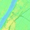
Tod topographic map

Click on the map to display elevation.

About this map

Name: Tod topographic map, elevation, terrain.

Location: Tod, Luxor, Egypt (25.56370 32.51124 25.60370 32.55124)

Average elevation: 86 m

Minimum elevation: 66 m

Maximum elevation: 155 m

Other topographic maps

Click on a map to view its topography, its elevation and its terrain.

Nagaa Al Tahtany

Egypt > Luxor > New Karnak

Average elevation: 77 m

Old Karnak

Egypt > Luxor

Average elevation: 78 m

New Al Qarnh City

Egypt > Luxor > Al-Qarnah

Average elevation: 123 m

Old Karnak

Egypt > Luxor

Average elevation: 78 m

Gear up for your next adventure:

🧣Merino Neck Gaiter - Protects against wind, sun, and cold at high altitudes
🩹Compact First Aid Kit - Pre-packed essentials for common trail injuries
🧊Portable Cooler - Keep food and drinks cold during outdoor adventures
🥾Trekking Poles - Adjustable trekking poles to reduce knee stress and improve stability
💡Portable Camping Lamp - Rechargeable lamp for campsite lighting

As an Amazon Associate, this site earns from qualifying purchases at no extra cost to you.