Geolocate

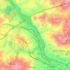
Mount Vernon topographic map

Click on the map to display elevation.

About this map

Name: Mount Vernon topographic map, elevation, terrain.

Location: Mount Vernon, Augusta, Richmond County, Georgia, 30906, United States (33.37458 -82.05317 33.41458 -82.01317)

Average elevation: 77 m

Minimum elevation: 44 m

Maximum elevation: 135 m

Other topographic maps

Click on a map to view its topography, its elevation and its terrain.
Gear up for your next adventure:

💡Compact LED Flashlight - Powerful and portable flashlight for outdoor use
🕯️Camping Lantern - Illuminates your entire campsite with high-efficiency LEDs
🎒Backpack Rain Cover - External shield to keep your entire pack dry
🧼Travel Hand Sanitizer - Keep hands clean when water is scarce
👟Trail Running Shoes - Agile footwear for fast-paced topographic exploration

As an Amazon Associate, this site earns from qualifying purchases at no extra cost to you.