Geolocate

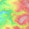
Eitelborn topographic map

Click on the map to display elevation.

About this map

Name: Eitelborn topographic map, elevation, terrain.

Location: Eitelborn, Montabaur, Westerwaldkreis, Rhineland-Palatinate, Germany (50.35161 7.68776 50.40166 7.74469)

Average elevation: 298 m

Minimum elevation: 117 m

Maximum elevation: 467 m

Other topographic maps

Click on a map to view its topography, its elevation and its terrain.

Hütte

Germany > Rhineland-Palatinate > Westerwaldkreis

Average elevation: 339 m

Gear up for your next adventure:

🧊Portable Cooler - Keep food and drinks cold during outdoor adventures
🧭GPS Handheld Device - Reliable GPS navigation for outdoor adventures
🚲Bike Repair Kit - Essential tools for on-trail mechanical issues
🥾Waterproof Trail Shoes - Shoes designed to handle wet terrain
🧦Outdoor Socks - Durable socks designed for hiking and outdoor sports

As an Amazon Associate, this site earns from qualifying purchases at no extra cost to you.