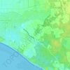
Les Blanches topographic map
Click on the map to display elevation.
About this map

Name: Les Blanches topographic map, elevation, terrain.
Average elevation: 4 m
Minimum elevation: -1 m
Maximum elevation: 16 m
Other topographic maps
Click on a map to view its topography, its elevation and its terrain.

Île de Ré
France > Nouvelle-Aquitaine > Charente-Maritime > Le Bois-Plage-en-Ré
Sa superficie est d’environ 85 km2, ce qui en fait la quatrième île de la France métropolitaine, loin derrière la Corse (8 680 km2), et proche de l'île d'Oléron (174 km2) et de Belle-Ile (85,63 km2). L’Île possède un isthme : le Martray. Très étroit, il ne mesure que 0,33 km de large et sépare…
Average elevation: 1 m