Geolocate

Calvados topographic map

Click on the map to display elevation.

About this map
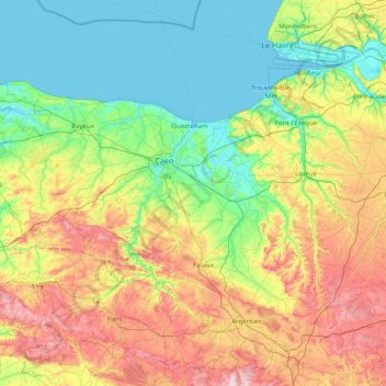
Name: Calvados topographic map, elevation, terrain.

Location: Calvados, Normandy, Metropolitan France, France (48.75166 -1.15977 49.42987 0.44663)

Average elevation: 117 m

Minimum elevation: -3 m

Maximum elevation: 407 m

Gear up for your next adventure:

🔦LED Headlamp - Hands-free lighting for early morning starts or late finishes
🛏️Sleeping Bag - Warm and compact sleeping bags for outdoor camping
💧Hydration Bladder - Hands-free hydration solution for long treks
🧢Outdoor Visor - Breathable visor for sunny hikes
🥾Approach Shoes - Shoes designed for climbing approaches and rugged trails

As an Amazon Associate, this site earns from qualifying purchases at no extra cost to you.