Geolocate

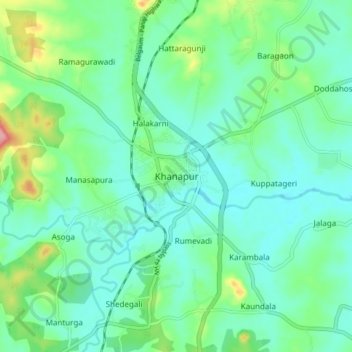
Khanapur topographic map

Click on the map to display elevation.

Khanapur

Khanapur has an elevation of 646 metres (2,119 ft).

Wikipedia (CC-BY-SA 3.0)

About this map

Name: Khanapur topographic map, elevation, terrain.

Location: Khanapur, Khanapura taluku, Belagavi, Karnataka, 591302, India (15.59878 74.46610 15.67878 74.54610)

Average elevation: 669 m

Minimum elevation: 639 m

Maximum elevation: 763 m

Gear up for your next adventure:

💡Portable Camping Lamp - Rechargeable lamp for campsite lighting
💧Hydration Bladder - Hands-free hydration solution for long treks
🪑Insulated Seat Pad - Protect your seat from cold rocks and wet logs
🥾Hiking Leggings - Comfortable leggings for outdoor activities
🥾Light Trekking Boots - Supportive boots for multi-day treks

As an Amazon Associate, this site earns from qualifying purchases at no extra cost to you.