Geolocate

Halbars topographic map

Click on the map to display elevation.

About this map

Name: Halbars topographic map, elevation, terrain.

Location: Halbars, Clohars-Carnoët, Quimper, Finistère, Bretagne, France métropolitaine, 29360, France (47.76145 -3.61327 47.80145 -3.57327)

Average elevation: 32 m

Minimum elevation: 0 m

Maximum elevation: 68 m

Other topographic maps

Click on a map to view its topography, its elevation and its terrain.
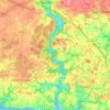
La Laïta

France > Bretagne > Finistère > Clohars-Carnoët

Average elevation: 45 m

Gear up for your next adventure:

🧥Fleece Jacket - Warm and lightweight jacket for layering
🎒Hiking Backpack - Lightweight and ergonomic backpacks for day hikes or multi-day treks
🕶️Polarized Sunglasses - Reduces glare from snow and water at high elevations
⛺Tent Footprint - Protect tent floor and increase durability
🥾Hiking Shorts - Breathable shorts suitable for summer hikes

As an Amazon Associate, this site earns from qualifying purchases at no extra cost to you.