Geolocate

Waipukurau topographic map

Click on the map to display elevation.

About this map
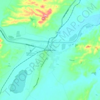
Name: Waipukurau topographic map, elevation, terrain.

Location: Waipukurau, Central Hawke's Bay District, Hawke's Bay, 4200, New Zealand (-40.03560 176.51671 -39.95560 176.59671)

Average elevation: 153 m

Minimum elevation: 118 m

Maximum elevation: 305 m

Other topographic maps

Click on a map to view its topography, its elevation and its terrain.

Gear up for your next adventure:

🍽️Titanium Camping Spork - Ultralight and indestructible eating utensil
🌡️Emergency Mylar Blankets - Compact thermal protection for unexpected nights outdoors
🧥Softshell Jacket - Windproof and breathable jacket for hiking
🦟Insect Repellent - Keep mosquitoes and black flies away in wooded areas
🥾Trail Hiking Boots - Supportive boots for rough trails

As an Amazon Associate, this site earns from qualifying purchases at no extra cost to you.