Geolocate

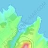
Trevías topographic map

Click on the map to display elevation.

About this map

Name: Trevías topographic map, elevation, terrain.

Location: Trevías, Valdés, Asturias, 33785, España (43.47609 -6.48187 43.53566 -6.36767)

Average elevation: 210 m

Minimum elevation: 0 m

Maximum elevation: 646 m

Other topographic maps

Click on a map to view its topography, its elevation and its terrain.

Ranón

España > Asturias > Valdés

Average elevation: 125 m

Playa de Barayo

España > Asturias > Valdés

Average elevation: 39 m

Alienes

España > Asturias > Valdés

Average elevation: 408 m

Monte Faro

España > Asturias > Valdés

Average elevation: 111 m

Trevías

España > Asturias > Valdés

Average elevation: 148 m

El Mazo

España > Asturias > Valdés

Average elevation: 526 m

Villademoros

España > Asturias > Valdés

Average elevation: 94 m

San Pedro de Paredes

España > Asturias > Valdés

Average elevation: 268 m

Luarca

España > Asturias > Valdés

Average elevation: 94 m

Gear up for your next adventure:

🔦UV Flashlight - Detect minerals or specific insects in the dark
🧥Softshell Jacket - Windproof and breathable jacket for hiking
🔭Outdoor Binoculars - Lightweight binoculars for birdwatching and hiking
🥾Approach Shoes - Shoes designed for climbing approaches and rugged trails
🧶550 Survival Paracord - Versatile utility cord for emergency repairs and rigging

As an Amazon Associate, this site earns from qualifying purchases at no extra cost to you.