Geolocate

Pampa topographic map

Click on the map to display elevation.

About this map
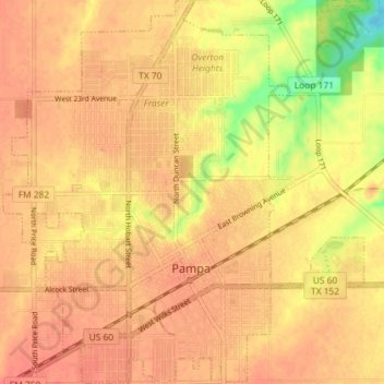
Name: Pampa topographic map, elevation, terrain.

Location: Pampa, Gray County, Texas, 79065, United States (35.51855 -100.99568 35.57719 -100.92760)

Average elevation: 983 m

Minimum elevation: 948 m

Maximum elevation: 994 m

Other topographic maps

Click on a map to view its topography, its elevation and its terrain.
Alanreed

United States > Texas > Gray County

Average elevation: 904 m

Gear up for your next adventure:

👟Leg Gaiters - Keep debris, mud, and snow out of your boots
🛌Down Sleeping Bag - Superior warmth-to-weight ratio for cold nights
🕯️Camping Lantern - Illuminates your entire campsite with high-efficiency LEDs
🥽Outdoor Goggles - Protective eyewear for outdoor activities
💡Portable Camping Lamp - Rechargeable lamp for campsite lighting

As an Amazon Associate, this site earns from qualifying purchases at no extra cost to you.