Geolocate

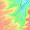
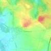
Teneur topographic map

Click on the map to display elevation.

About this map

Name: Teneur topographic map, elevation, terrain.

Location: Teneur, Arras, Pas-de-Calais, Hauts-de-France, Metropolitan France, 62134, France (50.43267 2.18844 50.46770 2.24612)

Average elevation: 88 m

Minimum elevation: 43 m

Maximum elevation: 135 m

Other topographic maps

Click on a map to view its topography, its elevation and its terrain.

Panehem

France > Hauts-de-France > Pas-de-Calais > Samer

Average elevation: 70 m

Le Petit Vimy

France > Hauts-de-France > Pas-de-Calais > Vimy

Average elevation: 93 m

Noyelles

France > Hauts-de-France > Pas-de-Calais > Bours

Average elevation: 125 m

Gear up for your next adventure:

🛶Kayak Accessories - Essential gear for safe and fun kayaking adventures
💧Hydration Pack - Hands-free hydration system for long hikes
🧦Thermal Socks - Warm socks for winter hiking or camping
🧴Waterproofing Spray - Restore the DWR coating on jackets and tents
🧥Thermal Fleece Jacket - Versatile insulation for changing mountain temperatures

As an Amazon Associate, this site earns from qualifying purchases at no extra cost to you.