Geolocate

Bad Schönborn topographic map

Click on the map to display elevation.

About this map
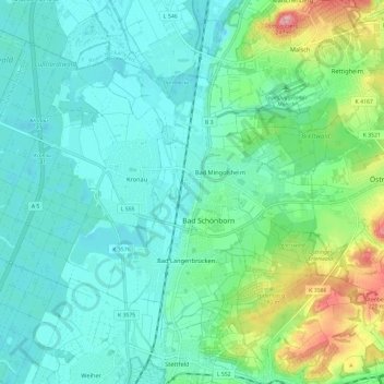
Name: Bad Schönborn topographic map, elevation, terrain.

Location: Bad Schönborn, VVG der Gemeinde Bad Schönborn, Landkreis Karlsruhe, Baden-Württemberg, 76669, Germany (49.18947 8.57346 49.24343 8.69149)

Average elevation: 134 m

Minimum elevation: 98 m

Maximum elevation: 245 m

Other topographic maps

Click on a map to view its topography, its elevation and its terrain.

Gear up for your next adventure:

🥾Lightweight Hiking Boots - Boots for comfort and mobility on long hikes
🥾Trail Hiking Socks - Comfortable socks to prevent blisters and fatigue
🔦LED Headlamp - Hands-free lighting for early morning starts or late finishes
🔥Emergency Fire Starter - Reliable ignition source for all weather conditions
🧥Ultralight Puffy Jacket - Maximum warmth that packs down to the size of an orange

As an Amazon Associate, this site earns from qualifying purchases at no extra cost to you.