Geolocate

Oxnard topographic map

Click on the map to display elevation.

About this map
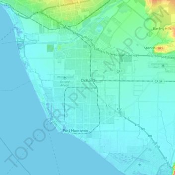
Name: Oxnard topographic map, elevation, terrain.

Location: Oxnard, Ventura County, California, United States (34.11932 -119.32922 34.26147 -119.11970)

Average elevation: 16 m

Minimum elevation: -1 m

Maximum elevation: 179 m

Other topographic maps

Click on a map to view its topography, its elevation and its terrain.
Oak Park

United States > California > Ventura County

Average elevation: 378 m

Gear up for your next adventure:

🧶550 Survival Paracord - Versatile utility cord for emergency repairs and rigging
🧭GPS Outdoor Watch - Smart watch for navigation and fitness tracking in nature
🛌Down Sleeping Bag - Superior warmth-to-weight ratio for cold nights
👖Convertible Hiking Pants - Zip-off legs to adapt to changing weather conditions
🧥Packable Rain Jacket - Breathable waterproof layer for unpredictable weather

As an Amazon Associate, this site earns from qualifying purchases at no extra cost to you.