Geolocate

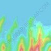
Kamandag Beach topographic map

Click on the map to display elevation.

About this map

Name: Kamandag Beach topographic map, elevation, terrain.

Location: Kamandag Beach, Sapang I, Ternate, Cavite, Calabarzon, 4111, Philippines (14.28109 120.69129 14.28267 120.69603)

Average elevation: 24 m

Minimum elevation: 0 m

Maximum elevation: 129 m

Other topographic maps

Click on a map to view its topography, its elevation and its terrain.
Paniman Beach

Philippines > Cavite > Ternate > Sapang I

Average elevation: 29 m

Gear up for your next adventure:

🧥Waterproof Pants - Keep dry during rainy hiking conditions
👟Trail Running Shoes - Agile footwear for fast-paced topographic exploration
🥾Trail Hiking Shoes - Durable shoes designed for rugged trails
🎒Backpack Rain Cover - External shield to keep your entire pack dry
🌡️Emergency Mylar Blankets - Compact thermal protection for unexpected nights outdoors

As an Amazon Associate, this site earns from qualifying purchases at no extra cost to you.