Geolocate

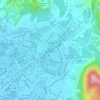
Kampung Aman topographic map

Click on the map to display elevation.

About this map

Name: Kampung Aman topographic map, elevation, terrain.

Location: Kampung Aman, Taiping, Larut, Matang and Selama, Perak, 34000, Malaysia (4.80979 100.72551 4.84979 100.76551)

Average elevation: 48 m

Minimum elevation: 8 m

Maximum elevation: 311 m

Other topographic maps

Click on a map to view its topography, its elevation and its terrain.

Sungai Reba

Malaysia > Perak > Taiping

Average elevation: 4 m

Larut River

Malaysia > Perak > Taiping

Average elevation: 3 m

Sungai Jebong

Malaysia > Perak > Taiping

Average elevation: 46 m

Gear up for your next adventure:

🧰Multitool Knife - Compact and versatile tool for outdoor use
🧢Hiking Sun Hat - Wide-brimmed protection for exposed mountain ridges
🧤Insulated Winter Gloves - Heavy-duty protection for sub-zero Canadian adventures
🔦LED Headlamp - Hands-free lighting for early morning starts or late finishes
🥾Trekking Boots - Durable boots for long-distance trekking

As an Amazon Associate, this site earns from qualifying purchases at no extra cost to you.