Geolocate

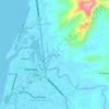
Galas topographic map

Click on the map to display elevation.

About this map

Name: Galas topographic map, elevation, terrain.

Location: Galas, Dipolog, Zamboanga del Norte, Zamboanga Peninsula, 7100, Philippines (8.52758 123.08195 8.76601 123.35552)

Average elevation: 24 m

Minimum elevation: -3 m

Maximum elevation: 573 m

Other topographic maps

Click on a map to view its topography, its elevation and its terrain.
Dicayas

Philippines > Zamboanga del Norte > Dipolog

Average elevation: 24 m

Minaog

Philippines > Zamboanga del Norte > Dipolog

Average elevation: 21 m

Dicayas

Philippines > Zamboanga del Norte > Dipolog

Average elevation: 24 m

Gear up for your next adventure:

🛌Down Sleeping Bag - Superior warmth-to-weight ratio for cold nights
👟Trail Running Shoes - Agile footwear for fast-paced topographic exploration
⛺Family Camping Tent - Spacious tent suitable for family camping trips
🧤Thermal Hiking Gloves - Grip-enhanced gloves for cold-weather altitude trekking
🥾Mountain Trail Shoes - High-traction shoes for mountain trails

As an Amazon Associate, this site earns from qualifying purchases at no extra cost to you.