Geolocate

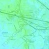
Daungan topographic map

Click on the map to display elevation.

About this map

Name: Daungan topographic map, elevation, terrain.

Location: Daungan, Guiguinto, Bulacan, Central Luzon, Philippines (14.85036 120.87273 14.86444 120.88986)

Average elevation: 6 m

Minimum elevation: 2 m

Maximum elevation: 11 m

Other topographic maps

Click on a map to view its topography, its elevation and its terrain.

Guiguinto River

Philippines > Bulacan > Guiguinto > Daungan

Average elevation: 5 m

Pulong Gubat Creek

Philippines > Bulacan > Guiguinto

Average elevation: 4 m

Pulong Gubat Creek

Philippines > Bulacan > Guiguinto

Average elevation: 5 m

St. Peter Village

Philippines > Bulacan > Guiguinto

Average elevation: 5 m

St. Peter Village

Philippines > Bulacan > Guiguinto

Average elevation: 5 m

Guiguinto River

Philippines > Bulacan > Guiguinto

Average elevation: 5 m

Gear up for your next adventure:

🥾Light Trekking Boots - Supportive boots for multi-day treks
🔦LED Headlamp - Hands-free lighting for early morning starts or late finishes
🔦LED Flashlight - Powerful and long-lasting flashlight for camping and emergencies
🥾Waterproof Hiking Shoes - Durable shoes for wet and rugged trails
🥘Camping Cookware Set - Compact nesting pots and pans for trail cooking

As an Amazon Associate, this site earns from qualifying purchases at no extra cost to you.