Geolocate

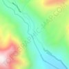
Songhangra topographic map

Click on the map to display elevation.

About this map

Name: Songhangra topographic map, elevation, terrain.

Location: Songhangra, Joshimath Tehsil, Chamoli, Uttarakhand, 246443, India (30.54493 79.65958 30.54503 79.65968)

Average elevation: 4,240 m

Minimum elevation: 3,553 m

Maximum elevation: 4,799 m

Other topographic maps

Click on a map to view its topography, its elevation and its terrain.

Hemkund

India > Uttarakhand > Joshimath Tehsil

Average elevation: 4,367 m

Mana

India > Uttarakhand > Joshimath Tehsil

Average elevation: 4,959 m

Saraswati

India > Uttarakhand > Joshimath Tehsil > Mana

Average elevation: 5,393 m

Nanda Ghunti Glacier

India > Uttarakhand > Joshimath Tehsil

Average elevation: 5,086 m

Gear up for your next adventure:

🎒Hiking Backpack - Lightweight and ergonomic backpacks for day hikes or multi-day treks
👟Trail Running Shoes - Agile footwear for fast-paced topographic exploration
🥾Trekking Poles - Adjustable trekking poles to reduce knee stress and improve stability
🛶Waterproof Dry Bags - Keep electronics and clothes dry during river crossings
⛺Family Camping Tent - Spacious tent suitable for family camping trips

As an Amazon Associate, this site earns from qualifying purchases at no extra cost to you.