Geolocate

La Plata topographic map

Click on the map to display elevation.

About this map

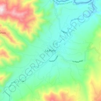
Name: La Plata topographic map, elevation, terrain.

Location: La Plata, Huila, Colombia (2.34942 -75.93262 2.42942 -75.85262)

Average elevation: 1,237 m

Minimum elevation: 922 m

Maximum elevation: 2,032 m

Gear up for your next adventure:

🥾Trekking Boots - Durable boots for long-distance trekking
🧼Travel Hand Sanitizer - Keep hands clean when water is scarce
🐕Hiking Dog Pack - Let your canine companion carry their own water and food
🛏️Camping Sleeping Mat - Comfortable mats for sleeping outdoors
🧢Hiking Sun Hat - Wide-brimmed protection for exposed mountain ridges

As an Amazon Associate, this site earns from qualifying purchases at no extra cost to you.