Geolocate

Sangli topographic map

Click on the map to display elevation.

About this map

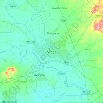
Name: Sangli topographic map, elevation, terrain.

Location: Sangli, Miraj, Sangli District, Maharashtra, 416416, India (16.69025 74.43489 17.01025 74.75489)

Average elevation: 574 m

Minimum elevation: 526 m

Maximum elevation: 871 m

Gear up for your next adventure:

🔋Solar Power Bank - Keep your GPS and devices charged during long outdoor trips
🥾Hiking Gaiters - Protect legs and shoes from mud, snow, and debris
🧢Hiking Sun Hat - Wide-brimmed protection for exposed mountain ridges
🧥Softshell Hiking Jacket - The perfect balance of wind protection and breathability
🧰Survival Kit - Essential gear for emergencies in the wilderness

As an Amazon Associate, this site earns from qualifying purchases at no extra cost to you.