Geolocate

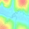
Minas Gerais topographic map

Click on the map to display elevation.

About this map

Name: Minas Gerais topographic map, elevation, terrain.

Location: Minas Gerais, Setor Norte, Uberlândia, Região Geográfica Imediata de Uberlândia, Região Geográfica Intermediária de Uberlândia, Minas Gerais, 38402-180, Brasil (-18.87501 -48.28077 -18.85194 -48.25410)

Average elevation: 906 m

Minimum elevation: 846 m

Maximum elevation: 938 m

Other topographic maps

Click on a map to view its topography, its elevation and its terrain.
Rio Uberabinha

Brasil > Minas Gerais > Uberlândia

Average elevation: 820 m

Rio Tijuco

Brasil > Minas Gerais > Uberlândia

Average elevation: 727 m

Rio Uberabinha

Brasil > Minas Gerais > Uberlândia

Average elevation: 813 m

Ribeirão Panga

Brasil > Minas Gerais > Uberlândia

Average elevation: 747 m

Praça

Brasil > Minas Gerais > Uberlândia

Average elevation: 910 m

Parque do Sol

Brasil > Minas Gerais > Uberlândia

Average elevation: 918 m

Pça. Continental

Brasil > Minas Gerais > Uberlândia

Average elevation: 899 m

Gear up for your next adventure:

🧴Sunscreen SPF - Broad-spectrum sunscreen for outdoor activities
🥽Outdoor Goggles - Protective eyewear for outdoor activities
☕Camping Coffee Maker - Brew fresh coffee anywhere on the topographic map
🔦LED Headlamp - Hands-free lighting for early morning starts or late finishes
💡LED Headlamp - Hands-free illumination for night hiking and camping

As an Amazon Associate, this site earns from qualifying purchases at no extra cost to you.