Geolocate

Maryborough topographic map

Click on the map to display elevation.

About this map

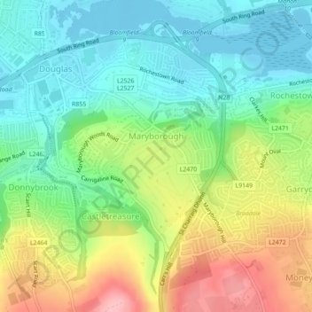
Name: Maryborough topographic map, elevation, terrain.

Location: Maryborough, Douglas, Cork, County Cork, Munster, Ireland (51.86286 -8.42884 51.87709 -8.41242)

Average elevation: 51 m

Minimum elevation: -4 m

Maximum elevation: 140 m

Other topographic maps

Click on a map to view its topography, its elevation and its terrain.

Cork

Ireland > County Cork > Cork

Average elevation: 94 m

Tramore Valley Park

Ireland > County Cork > Cork

Average elevation: 28 m

Upper Glanmire Bridge

Ireland > County Cork > Cork

Average elevation: 90 m

Fair Hill

Ireland > County Cork > Cork

Average elevation: 68 m

Ballincollig Regional Park

Ireland > County Cork > Cork

Average elevation: 55 m

Ballincollig

Ireland > County Cork > Cork

Average elevation: 62 m

Beaumont Park

Ireland > County Cork > Cork

Average elevation: 12 m

River Lee (North Channel)

Ireland > County Cork > Cork

Average elevation: 49 m

Kerry Pike

Ireland > County Cork > Cork

Average elevation: 55 m

Stone Beach

Ireland > County Cork > Cork

Average elevation: 47 m

River Lee (North Channel)

Ireland > County Cork > Cork

Average elevation: 32 m

Gear up for your next adventure:

🥾Trekking Boots - Durable boots for long-distance trekking
🧦Hiking Liner Socks - Thin base layer to prevent friction and blisters
🧥Thermal Layer - Insulating layer for cold outdoor conditions
💧Reusable Water Bottle - Durable water bottles for hydration on trails
🥾Mountain Hiking Shoes - Shoes with superior grip for mountainous terrain

As an Amazon Associate, this site earns from qualifying purchases at no extra cost to you.