
Pleasanton topographic map
Click on the map to display elevation.
About this map
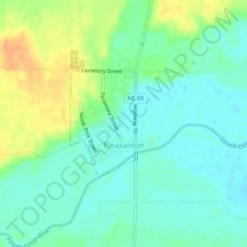
Name: Pleasanton topographic map, elevation, terrain.
Location: Pleasanton, Buffalo County, Nebraska, United States (40.96317 -99.09255 40.97491 -99.08291)
Average elevation: 643 m
Minimum elevation: 630 m
Maximum elevation: 667 m