Geolocate

Biramitrapur topographic map

Click on the map to display elevation.

About this map

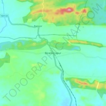
Name: Biramitrapur topographic map, elevation, terrain.

Location: Biramitrapur, Sundargarh District, Odisha, 770033, India (22.36654 84.69093 22.44654 84.77093)

Average elevation: 285 m

Minimum elevation: 229 m

Maximum elevation: 484 m

Gear up for your next adventure:

🕯️Camping Lantern - Illuminates your entire campsite with high-efficiency LEDs
🧦Hiking Liner Socks - Thin base layer to prevent friction and blisters
🧦Crew Hiking Socks - Comfortable socks for long-distance hikes
🧰Multitool Knife - Compact and versatile tool for outdoor use
🐕Hiking Dog Pack - Let your canine companion carry their own water and food

As an Amazon Associate, this site earns from qualifying purchases at no extra cost to you.